Elevation Maps for Trickling Filter Mechanism
Project Manager Insight: “The speed and efficiency of laser scanning allowed us to provide the client exactly what they were looking for while minimizing disruption to their plant.” Alex Vargas, Regional Manager, West Coast
Location: Salem, Oregon
Task: TruePoint’s task was to help the client determine the amount of rock that was overfilled in each trickling filter mechanism in the wastewater treatment plant.
Challenge: Exactly one foot of rock is required to be filled across the entire mechanism; however, the mechanism was overfilled with varying degrees throughout. Plant shut down was required for the scan, due to it being an active filter mechanism. The other option of emptying all the rock in the mechanism for measurement would have caused a major plant shutdown for a long period of time.
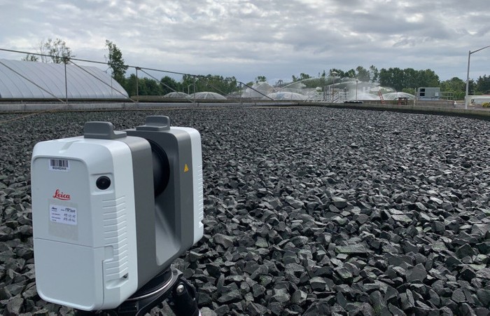
Solution: TruePoint laser scanned the existing rock in the mechanism to create a triangulated surface model that was used to get the average height and volume of the rock using a known datum point in the mechanism. The Leica RTC360 laser scanner was used to complete this project. 44 laser scans were taken on site.
Deliverables: The client received two elevation maps for each trickling filter mechanism, a standard elevation map, and an elevation map of the colored point cloud as PDF drawings. Autodesk Recap .rcs point cloud files and Jetstream Viewer files were sent for basic measuring, 3D navigation, scan point of view and fly-through.
Added Value: Laser scanning was the most efficient and accurate means of capturing the data for these mechanisms. The speed at which the scan was conducted allowed the client to have minimal shutdown time.
TruePoint has extensive experience 3D laser scanning water and wastewater treatment plants. For 3D laser scanning services in Oregon, call 206-300-1540 or email portland@truepointscanning.com.
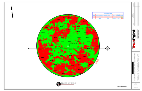
Exactly one foot of rock is required to be filled across the entire mechanism; however, it was overfilled with varying degrees throughout.
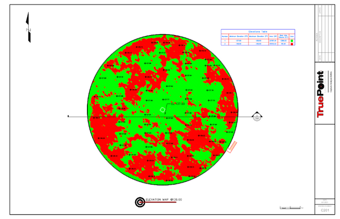
Civil 3D surface elevation map created from the point cloud of the trickling filter mechanism.
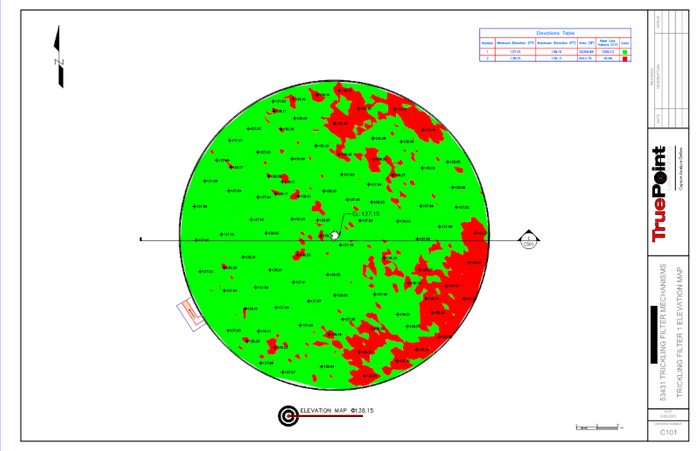
Civil 3D surface elevation map created from the point cloud.
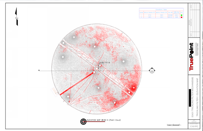
Point cloud elevation map of trickling filter mechanism.
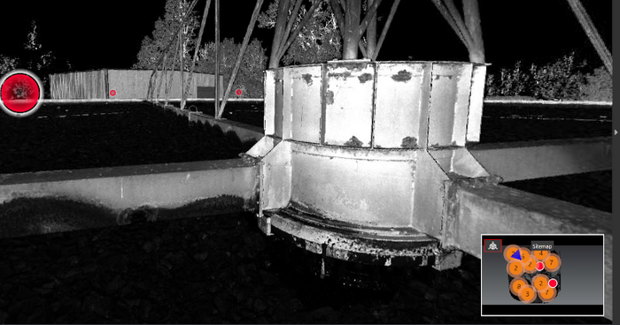
Leica JetStream RealView screenshot of project site.
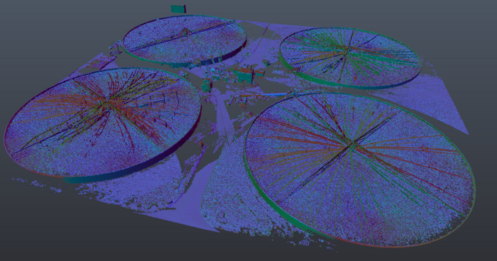
Autodesk ReCap point cloud screenshot of the four trickling filters.
